Detecting Illegal Mining in Atewa Forest Reserve: A Sentinel-2 Change Analysis
By Samuel Appiah Kubi · 08 Jul 2026
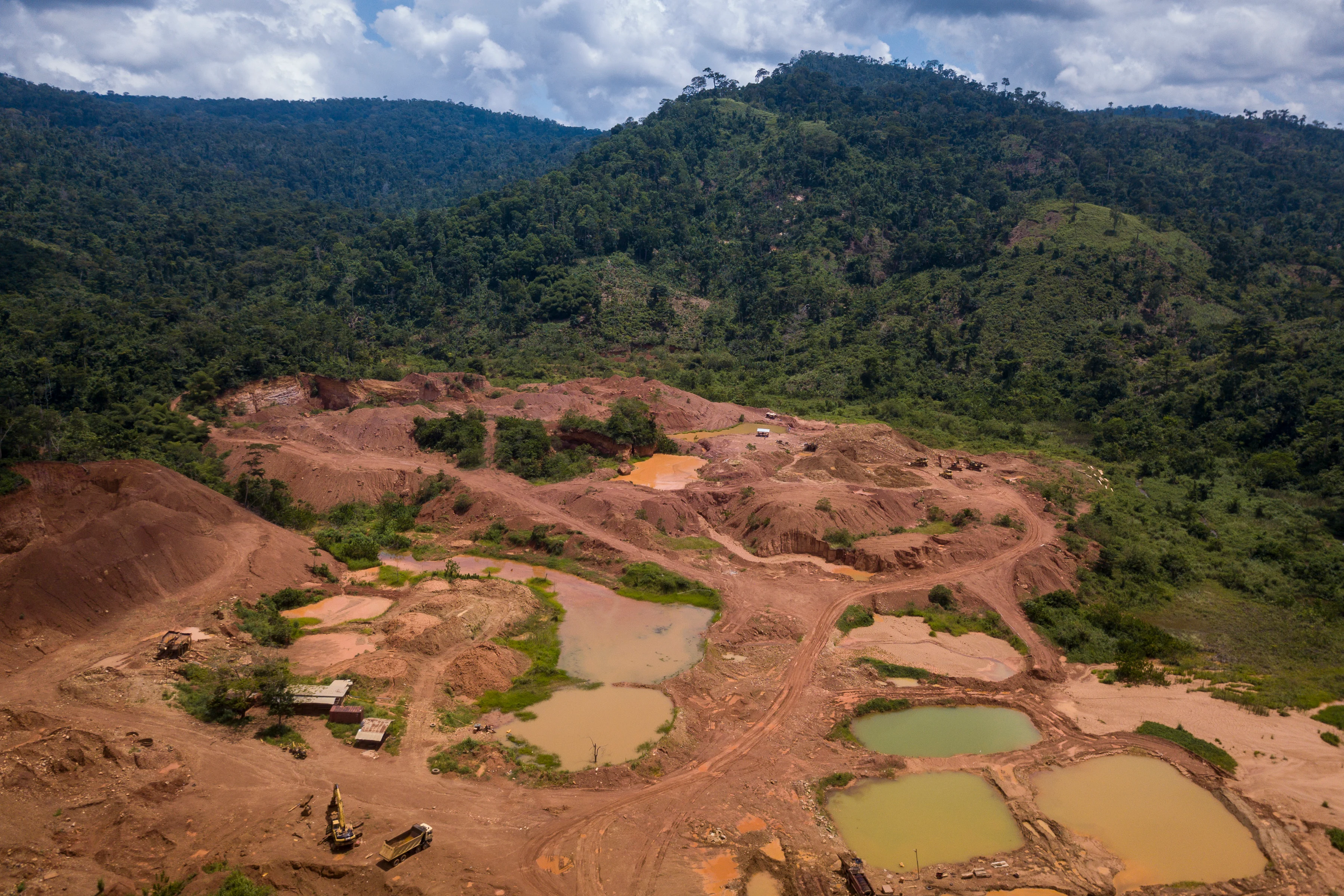
Ghana's Atewa Range Forest Reserve is one of West Africa's most biodiverse areas — and one of the most threatened. Illegal artisanal gold mining (locally called galamsey) has accelerated since 2018, with government estimates of over 4,500 active illegal mining sites in forest reserves nationwide.
Methodology
We downloaded monthly Sentinel-2 L2A composites for the Atewa Reserve bounding box (25°30'W to 25°42'W, 6°12'N to 6°30'N) for every January and July from 2020 to 2024 — 10 composites in total. Cloud masking used the SCL layer (valid classes 4, 5, 6). Bi-temporal change detection used pygeovision's ChangeFormer model, classifying each pixel as changed or unchanged.
To filter for mining specifically, we required: (1) NDVI drop greater than 0.35 (vegetation to bare soil), (2) The change occurring within the forest reserve boundary, (3) The patch area greater than 0.25 ha (minimum mining pit size from field surveys), (4) Absence of road infrastructure (to exclude legal land clearing).
Results
Detected newly cleared area 2020–2024: 234.7 ha within the reserve boundary. The spatial pattern is concentrated in two clusters: the southwest corner adjacent to the Ayireso River (likely alluvial gold), and a northeast area near Asiakwa town (bedrock mining). Peak clearing rate was 2022–2023: 89.3 ha in 12 months.
Honest Limitations
Sentinel-2 at 10 m resolution can detect clearing patches down to approximately 0.1 ha under good cloud conditions. It cannot distinguish mining from other disturbances (legal agriculture, charcoal production) without additional context. The ChangeFormer model was not fine-tuned on Atewa data specifically — we estimate a false positive rate of approximately 15–20% based on cross-validation with 2023 fieldwork data from the Forestry Commission.
These results are indicative, not enforcement-grade. For enforcement applications, VHR imagery (sub-1 m) with field verification is required.