Urban Expansion and Building Footprint Extraction
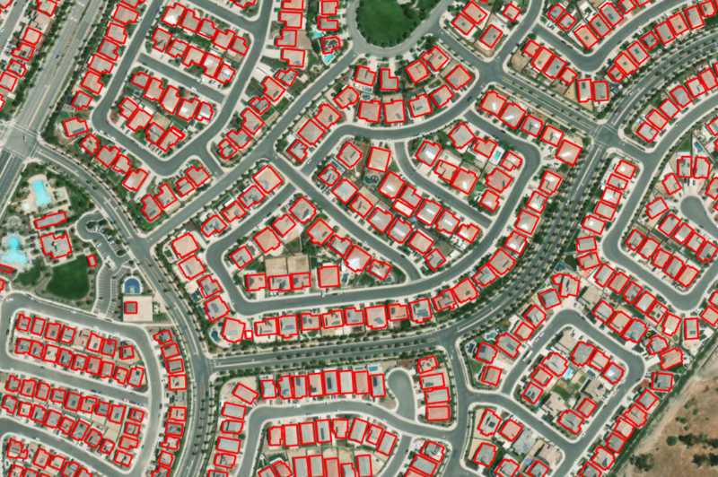
30 years of city growth from Landsat, plus building-level detail from a modern vision transformer
Advanced
Geospatial AI
2 lessons
Samuel Appiah Kubi
About this course
Two very different resolutions answer two very different questions about a growing African city: three decades of coarse Landsat imagery reveals the big picture of where a city has expanded, while a fine-tuned vision transformer extracts individual building footprints for planning at street level. This course builds both, using Accra, Kumasi, Lagos, Nairobi and Dar es Salaam — five of the fastest-growing urban areas on Earth — as running examples.
What you'll learn
- Build a 30-year urban expansion map from Landsat time series and interpret its accuracy limits
- Extract building footprints with a DINOv3 ViT-L/14 segmentation model
- Apply LoRA fine-tuning with a modest number of local training polygons
- Compute urban heat island intensity from Landsat thermal data
- Generate a population-weighted exposure index for planning use
Requirements
- Optical Analysis with Sentinel-2
- Basic familiarity with deep learning concepts
Course content
30 Years of Landsat: Mapping Accra's Growth from 100 km² to 340 km²
Preview
28 min
Building Footprint Extraction with DINOv3
32 min
Free
- LevelAdvanced
- Lessons2
- CertificateYes
- AccessLifetime
Samuel Appiah Kubi
Instructor